Twice a week, Christopher Lightfoot cycles 28 kilometres from his home in Lund to downtown Powell River, along the curvy, fast-moving Highway 101.
Pickup trucks barrel past him at 100-km an hour. Gravel flies. In the winter, it’s dark and often wet so he doesn’t ride, preferring to miss the precarious experience of exposing his unprotected body to the no-man’s-land of the road.
“I do it for the fun factor,” said Chris unironically.
He’s a speech-language pathologist who is also a world-travelling, experienced cyclist.
“One of the best parts of my day is riding to and from work, but I would never recommend it to someone else.”
That’s because it’s dangerous. And also, in many ways, awful. Although there is a painted white line separating trucks and cars from the few cyclists and pedestrians who brave the shoulder, the highway was clearly planned for fast-moving vehicles, rather than slower, more vulnerable humans. Chris believes many, many more people would reduce their car trips in favour of biking, e-biking or walking, if the experience of doing so was reasonable. Or, to dream, enjoyable.
As active transportation director for qathet Regional Cycling Association, Chris is at the helm of a movement pushing local governments to help locals make better transportation choices – by just making our roads and trails safer. He doesn’t need to push that hard. Both the City of Powell River and qathet Regional District have already committed, on paper, to doing just that – through the city’s 2021 Official Community Plan, and through the regional district’s Parks and Trails Strategy, among other documents.
To Chris, this work is a no-brainer. He learned to love commuting by bike in Vancouver. He’s the dad of two kids who cycle, ages seven and nine. When he later lived in the seaside town of Prince Rupert – with a population almost exactly the size of Powell River’s – he started advocating for better infrastructure.
“Prince Rupert is very densely populated, hemmed in by mountains and water,” he explained, “so it’s compact. It only takes a few minutes to drive across town. Many people just walk – they don’t even own cars. I started to ride my bike to work there, which was only 15 minutes. I just put my work clothes on under my rain gear.”
Of course, things there could have been better, too. He and a friend, who uses a wheelchair, got together and organized “Complete Streets for Prince Rupert,” a volunteer-led group advocating for inclusive, safe, enjoyable transportation infrastructure for all – not just drivers.
“The topic really resonated and struck a nerve with everyone,” he said. “Everyone wanted to share their near-miss story or the time they were hit, or the time someone they knew was killed. Some stories were truly tragic. Everyone thought this could be done better.”
When he moved to qathet two years ago, Chris was struck by two differences from Prince Rupert. The first is, unlike Prince Rupert’s compact urban design, this town is spread out along the coastline (and Texada Island) for dozens of kilometres; even within the city limits, neighbourhoods are spread out without protected pathways between them. The second is, qathet already has a large and growing number of people who walk, bike and e-bike, and are great self-advocates.
Promoting priorities
As someone who wants to lobby for a better active transportation system in qathet, Chris has no problem outlining his top priorities.
His first priority, and one the city has control over, is to complete a cycling network in the city limits that’s safe and easy for eight- to 80-year-olds alike, as outlined in the 2021 Bicycle Network Strategy. People want a safer, more comfortable experience on Joyce Avenue, he says.
Number two priority, surprisingly, is better transit. Active transportation, he explained, is not just about bikes. It’s about creating systems so people can realistically choose to reduce their car driving. What’s needed, he said, is a smooth, seamless, enjoyable, dependable network of transit and paths. When it’s torrential out, the bus is a better option for most folks than cycling or walking, he said. But only if it comes regularly, and goes where they’re going.
Number three, for governments to invest in a “AAA” path along Highway 101 – that is, something that is usable for “all ages and abilities.” Not just super-cyclists, but also children, seniors, people with dogs and just regular folks.
If you look only at Facebook, you might think this region hates active transportation. Or, at least, hates the infrastructure that supports it. The protected four-way stop on Manson Avenue and Duncan Street was a target for online rage, mostly about public tax dollar spending.
The bike lane near Mitchell Brothers, similarly, attracted so much ire it was removed. And discussion around the Maple and Sycamore Safer Streets initiative, which was designed to calm traffic along the side streets where children and teens walk and bike to Henderson Elementary School and Brooks Secondary School, degenerated into a neighbour-versus-neighbour relationship-destroying conflict.
Paralleling that online venom is some reality.
The economy is shifting. Cars are expensive. Running a basic, no-payments, fuel-efficient car costs at least $500 a month, including fuel, insurance and maintenance. Running anything can swiftly cost over $1,000 a month. If a family needs two basic cars to function, that’s at least $12,000 out of a median qathet household income of about $56,000 a year – before taxes. Or, $1,000 out of a monthly income of about $4,500 a month.
More reality: climate change is causing catastrophic impacts in the form of wildfires, storms and more. According to qathet Climate Alliance, private vehicles here are responsible for about 70 per cent of CO2 emissions.
And even more reality: lots of people just prefer walking and cycling over driving. And they pay taxes too. How much infrastructure spending do they deserve? How much of the road are they entitled to?
Planning problems
These are questions that city director of planning services Jason Gow grapples with at his desk at Powell River City Hall. Jason is charged with reimagining a city centre that was designed in another era – one that believed the single-occupancy vehicle was universal, and forever.
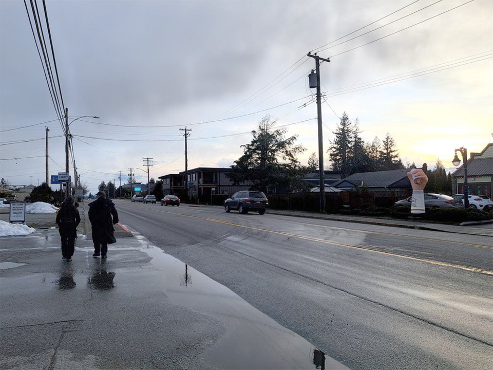
Townsite and Marine Avenue business districts were built before the 1960s car mania, he explained, so they’re relatively enjoyable to stroll or cycle. But Joyce Avenue – the long stretch of residential leading up from the highway, through the centre where the grocery stores, banks, doctors offices and other essential services are, to Powell River Recreation Complex, qathet General Hospital and large, dense, new residential developments – this should be exactly where folks feel most comfortable circulating. Instead, he said, it’s uninviting.
“I just don’t think the experience of the pedestrian was ever considered,” he said. “It’s dangerous and unpleasant to cross on foot.”
Jason has seen umpteen people riding mobility scooters wedged between the traffic and the sidewalk; there are so many driveways along Joyce – places where cars cross pedestrian paths – it makes riding in a wheelchair on the uneven sidewalk nearly impossible.
Even for pedestrians walking near the malls on Joyce, negotiating around cars constantly crossing sidewalks makes the experience alarming. People living in the new 24-unit building across from Powell River Visitor Centre and the Community Resource Centre sometimes choose to drive across the street to the mall, he says, rather than go down to the crosswalks to get across the three lanes on Joyce.
Some active transportation solutions are relatively easy because they’re tucked away from the main streets.
For example, the mid-level connector project aims to be completed this year. That’s the path that connects Brooks Secondary to the recreation complex through the forest. It is funded with money from the province and the Powell River Community Forest, mostly.
New trails through the resource-recovery centre near Willingdon Beach are also relatively easy, as those are part of a project already in the works. But some projects are less straight forward. Anything that impacts drivers is tough, he said.
“It can be hard to gain support for change because the vast majority of our community rely on getting around using single-occupancy vehicles,” he added.
But Joyce is on the city’s radar, as it is identified as a key active transportation route in the city’s Bicycle Network Strategy and Official Community Plan. Addressing this corridor will require significant grappling on the part of all city staff.
It is three-lanes wide, with a long two-direction turning lane in the middle. All that space for cars means pedestrians, cyclists and those on mobility scooters lose their protection. There is no room for trees that might separate those out of cars from those in cars. Sidewalks are narrow. Cyclists have to navigate through a wild maze of cars turning into and out of the malls, or around corners.
Infrastructure investments
Jason said he has learned a lot, as a planner, from the experience with public engagement around the Mitchell Brothers bike lane and the Manson four-way stop. Building new infrastructure is expensive, and that’s a stumbling block for many citizens, he noted. Although, Jason pointed out, the city has a limited budget for active transportation; nearly all money comes from other levels of government in the form of grants, and from the community forest.
“We have to remember that change is hard for some. We are changing. But it’s about how we manage change,” said Jason. “Can we be more open or receptive to those individuals who might not want to see any investment in any infrastructure that they don’t use? I also think we need to make sure people understand where the money is coming from, as it may ease some tensions.”
It’s also hard to sell a future to people who can’t imagine things working differently.
Jason grew up on Vancouver’s North Shore, a landscape physically much like Powell River. However, much of the forest was preserved and little trails connected neighbourhood to neighbourhood, all the way across the municipalities.
“I always felt so free,” he recalls, noting that the trails made bike commuting at least as time efficient as driving.
“This is what we’re trying to achieve with the mid-level connector and Willingdon Beach Trail.”
Ultimately, Jason said, active transportation planning is about safety for everyone: pedestrians, cyclists, those using mobility scooters, and drivers.
Join the Peak's email list for the top headlines right in your inbox Monday to Friday.


