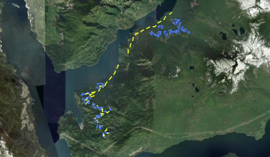
Tsain-ko Forestry Development Corporation has announced a Forest Operations Map (FOM) for harvesting and building associated roads near Narrows Inlet.
The map can be found online and is open to public comment until Nov. 5.
FOM 1880 proposes 19 cut blocks and associated road sections in two main areas. The first area is near Storm Bay and the other is farther up the inlet, past Tzoonie Narrows.
While most of the proposed cut blocks are three to seven hectares (ha), the FOM contains larger ones, such as Block 27983 at 26ha and Block 27996 at 14.4ha.
In total, 12.8km of road sections are included in the FOM.
The planned development date for the road sections is Dec. 1, 2024, while the cut block’s proposed harvest date is set for Dec. 1, 2025.
The FOM is valid until Oct. 5, 2027, meaning the applicant has until that date to apply for cutting permits and road permits for plans proposed in this map.
The period of operation is set from 2024 to 2028.
Jordan Copp is the Coast Reporter’s civic and Indigenous affairs reporter. This reporting beat is made possible by the Local Journalism Initiative.
Words missing in article? Your adblocker might be preventing hyperlinked text from appearing.


