A draft land-use map for the City of Powell River’s official community plan (OCP) includes a number of significant changes from the existing plan.
Consultants hired to review the city’s OCP unveiled the map at meetings in Wildwood and Cranberry last week. Residents have been asked to provide comments on the proposed land use designations, as well as on policies and objectives and proposed cycling and transportation networks. Comments can be made on the website set up for the OCP review, http://powellriverocp.com, until May 31.
In the process so far, there have been about 200 people participating at various forums. As well, the consultants held a youth engagement session at Brooks Secondary School on May 14, which attracted about 80 students.
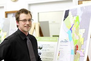
Graham Farstad, of The Arlington Group, provided an overview of the land-use map at the Cranberry meeting.
The general feeling from participants in the process was to keep Cranberry as a residential area, said Farstad. “Typically, there’s no great call for densification,” he said. “We’re identifying the area on the east side of Cranberry Lake as suburban-rural, definitely low density, and other areas as largely single-family, not huge density again.”
There’s potential for some increase in densification around the commercial area along with some mixed use, Farstad said, to add more traffic and revitalize the commercial area.
To recognize the number of parks around the lake, the map shows it surrounded with a green area, which also provides for possibility in the long term of continuous waterfront access.
There are a number of areas designated Employment Centre-Business Park west of Cranberry and north of Powell River Recreation Complex. The designation can include anything from film production, call centre, warehousing, high-tech park and office uses, Farstad said. The Duncan Street corridor east of Joyce Avenue also has the designation, as well as the airport lands and Tla’amin (Sliammon) First Nation treaty settlement land.
The designation also shows up north of the Catalyst mill on the west side of Highway 101 and south of the mill on the waterfront, below what is known as the old golf course, which provides for waterfront business park opportunities.
Wildwood remains suburban residential, essentially unchanged except for an area between the Shinglemill and Atlin Avenue that is designated Urban Residential Low Density. All ALR (Agriculture Land Reserve) lands are designated Agriculture. “We haven’t reached that point yet, but there’s been pretty strong support for activities to improve agricultural production and make it more viable,” Farstad said. “It’s surprisingly a strong sentiment we picked up from the students at the high school.”
The Townsite area is designated Urban Residential Single Family, except for a Mixed Use Commercial-Residential area that encompasses businesses on Ash and Arbutus avenues down to Walnut Street.
As well, the OCP is proposing a heritage conservation area for Townsite. “It would have controls to ensure that new development replicates or is compatible, as much as possible, with what the National Historic Site designation is for that area,” said Farstad.
To the south of Townsite, the section of waterfront land bordering the light industrial area north to the haul road is designated Urban Residential Low Density.
Westview is seen as the prime growth opportunity, Farstad said. A Mixed Use Shopping Centre designation reflects existing commercial operations. “That would be an area that is mainly commercial, but we’re suggesting that it could accommodate mixed use, multi-family residential,” he said. “It would accommodate residential uses so it’s not just big-box heaven.”
West of Joyce down to Marine Avenue is designated Urban Residential Medium Density. “Existing residential would stay, but it would allow for an opportunity for rezoning applications to look at duplexes, townhouses and some low-rise apartments,” Farstad said.
Marine down to the waterfront is designated Mixed Use Commercial-Residential. The vacant property on the corner of Marine and Abbotsford Street, known as the old arena site, has the same designation.
Moving south, there is little change as the area remains mostly single-family residential. The undeveloped area north of Teakerne Street, east of Ontario Avenue and south of Nootka Street is designated agriculture, rather than urban residential, in order to achieve a more compact situation for densification, Farstad said.
Over the summer, the consultants will be working with final comments and more detailed policies, Farstad said. There will be an open house in the fall, probably in September, he added, followed by a public hearing prior to adoption at council.


